La Rochelle → Gibraltar
Offline snapshot · fetched Fri, 17 Apr 2026 20:11:36 GMT (1.0 hr old)
Voyage
Atlantic passage from La Rochelle (France) down the Bay of Biscay, past Cape Finisterre and Cape São Vicente, to Gibraltar. Storms approach from the west off the Atlantic — NOAA OPC is the primary synoptic source; GFS-Europe via Wetterzentrale for wind / precip / CAPE.
CLI equivalent: npm run voyage refresh biscay-gibraltar
AI weather briefing
Weather Briefing — La Rochelle → Gibraltar
Issued: Fri 17 Apr 2026 20:11 UTC · Advisory only — verify against local forecasts underway.
Current synoptic setup
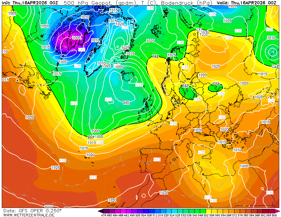
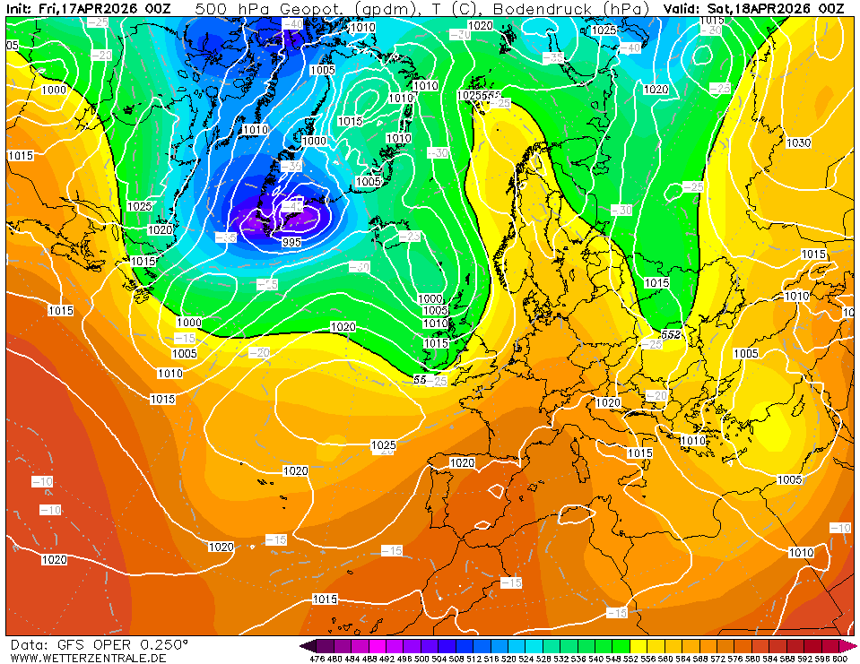
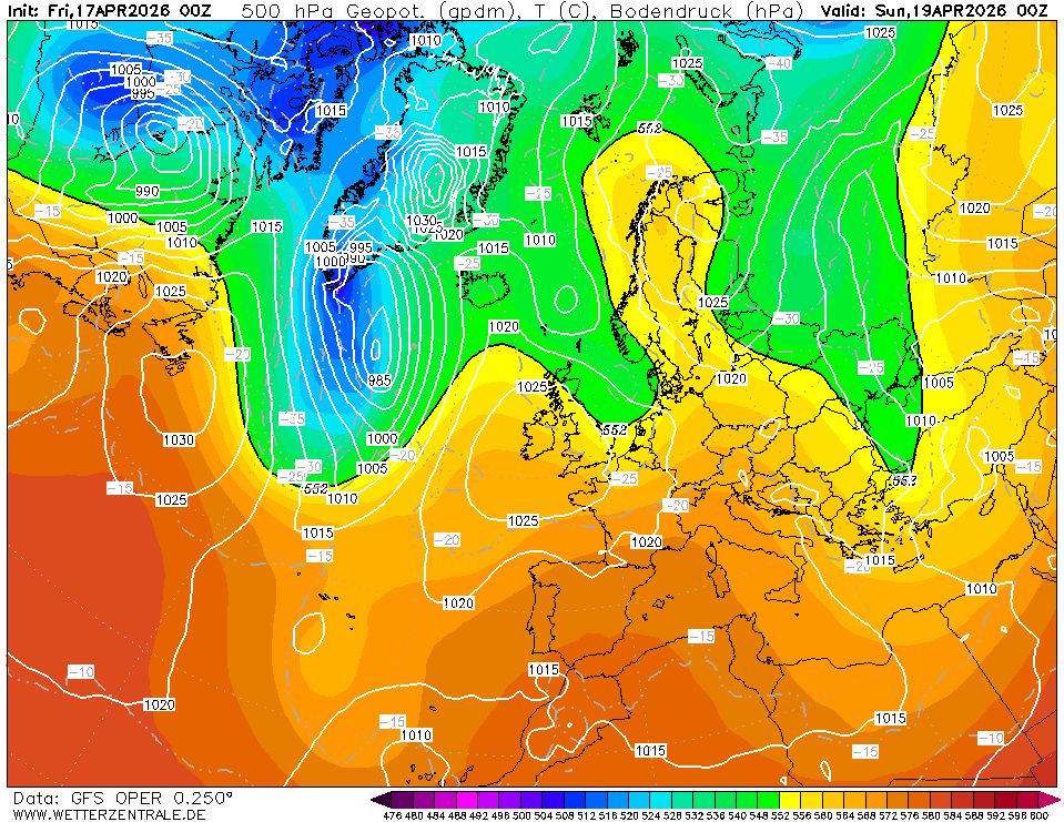
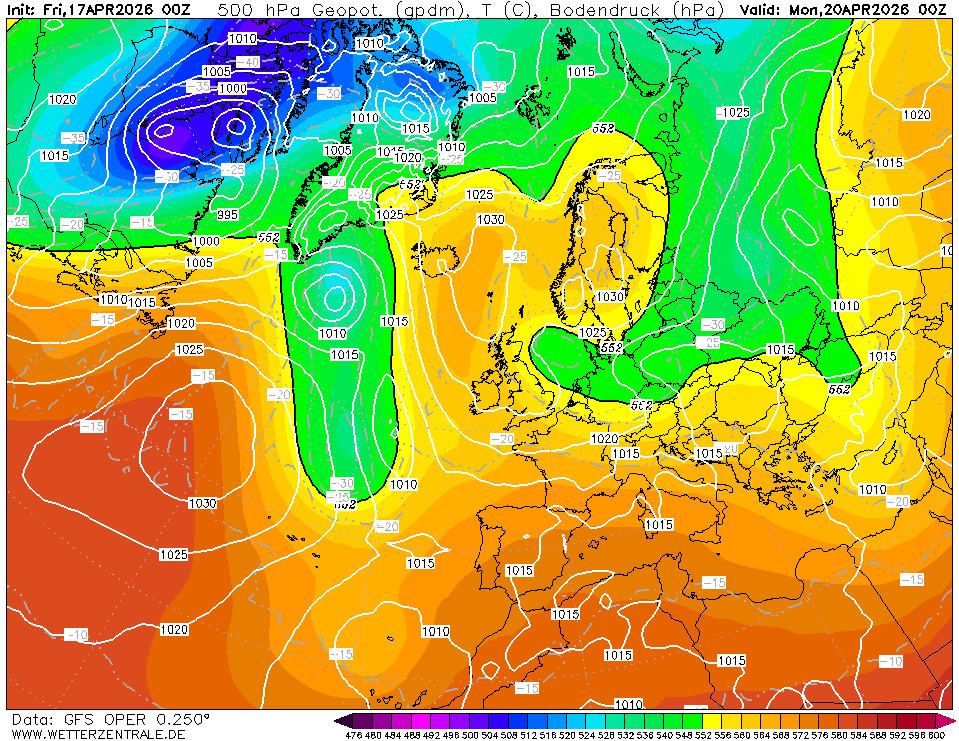
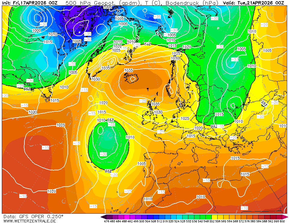
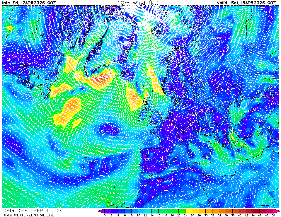
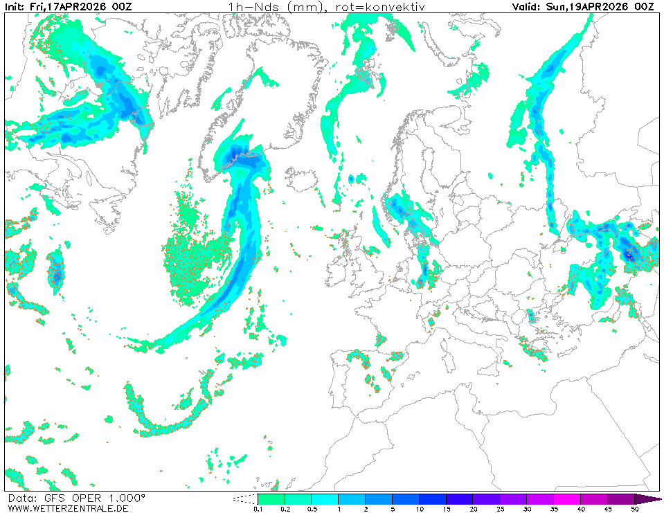
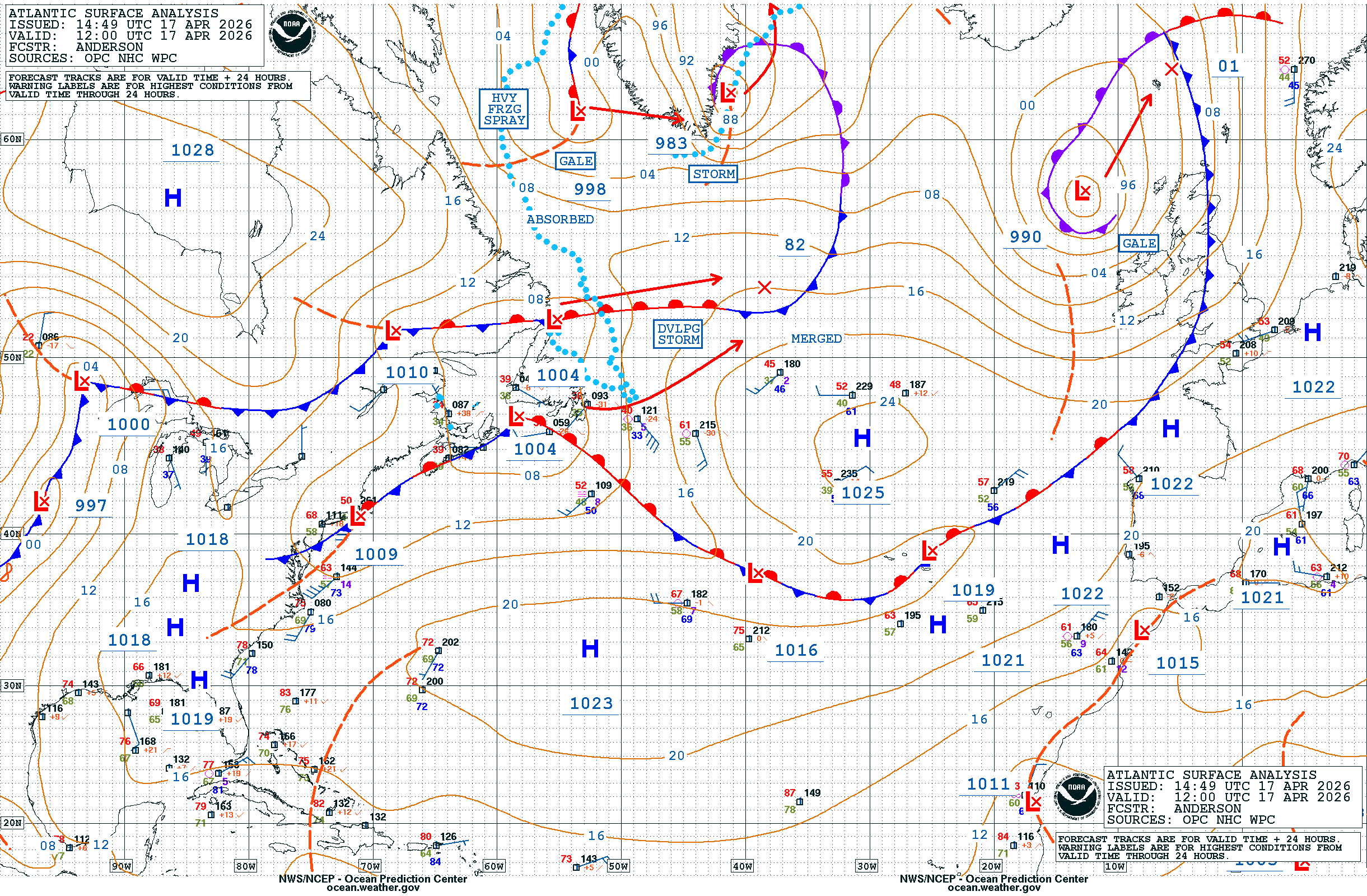
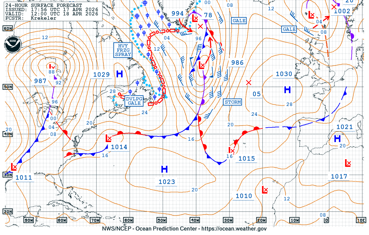
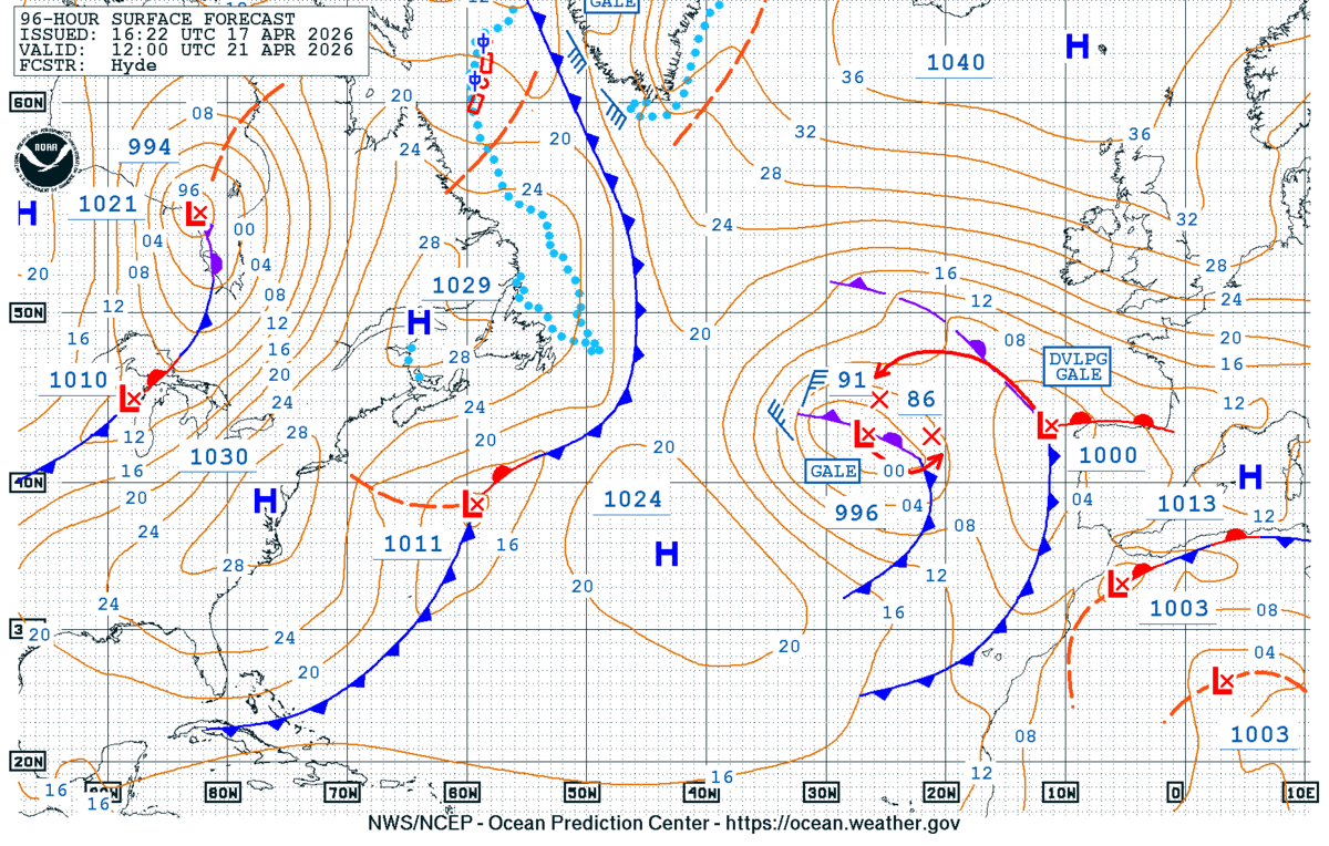
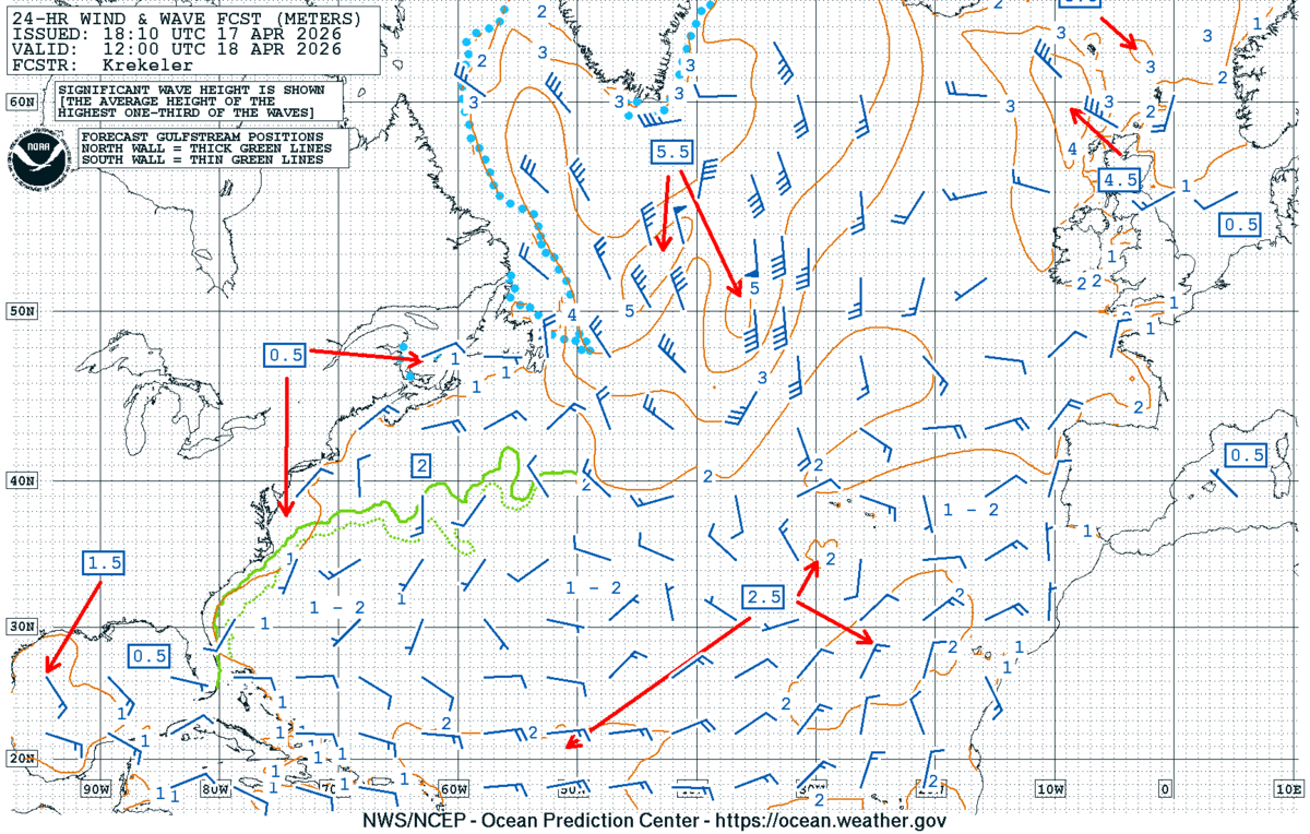
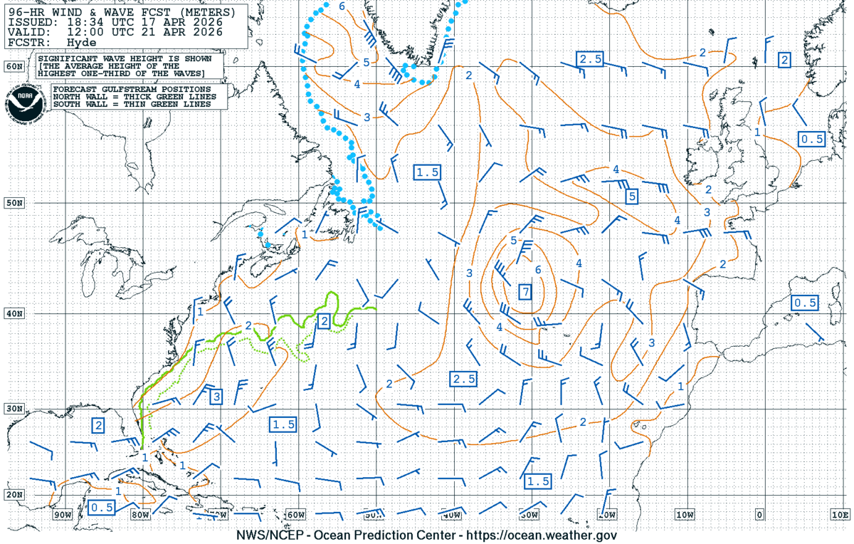
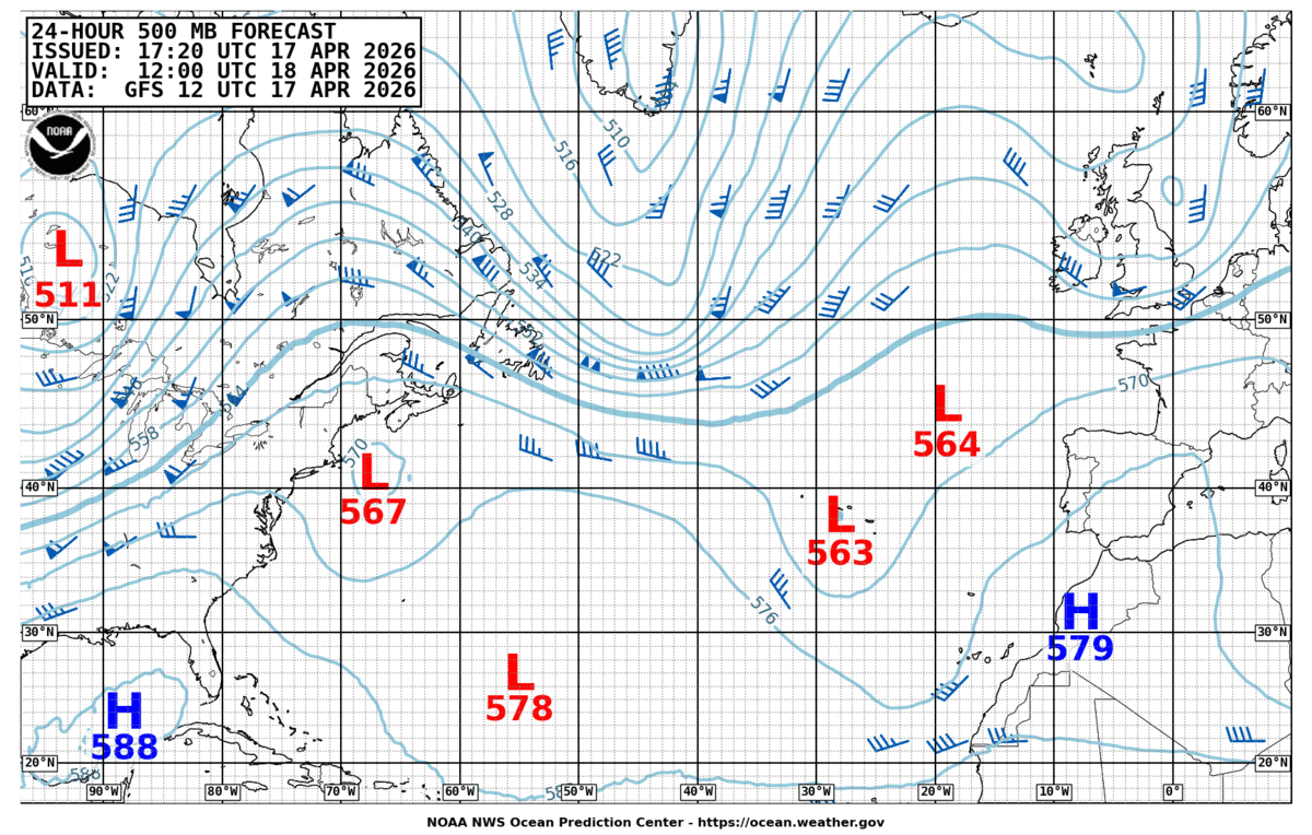
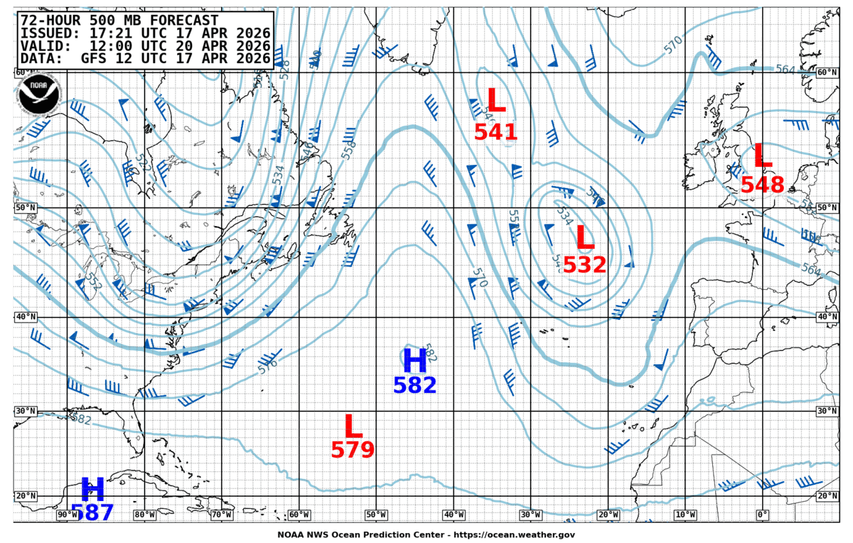
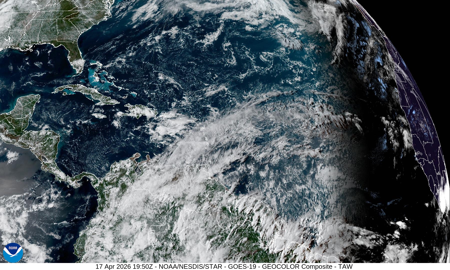
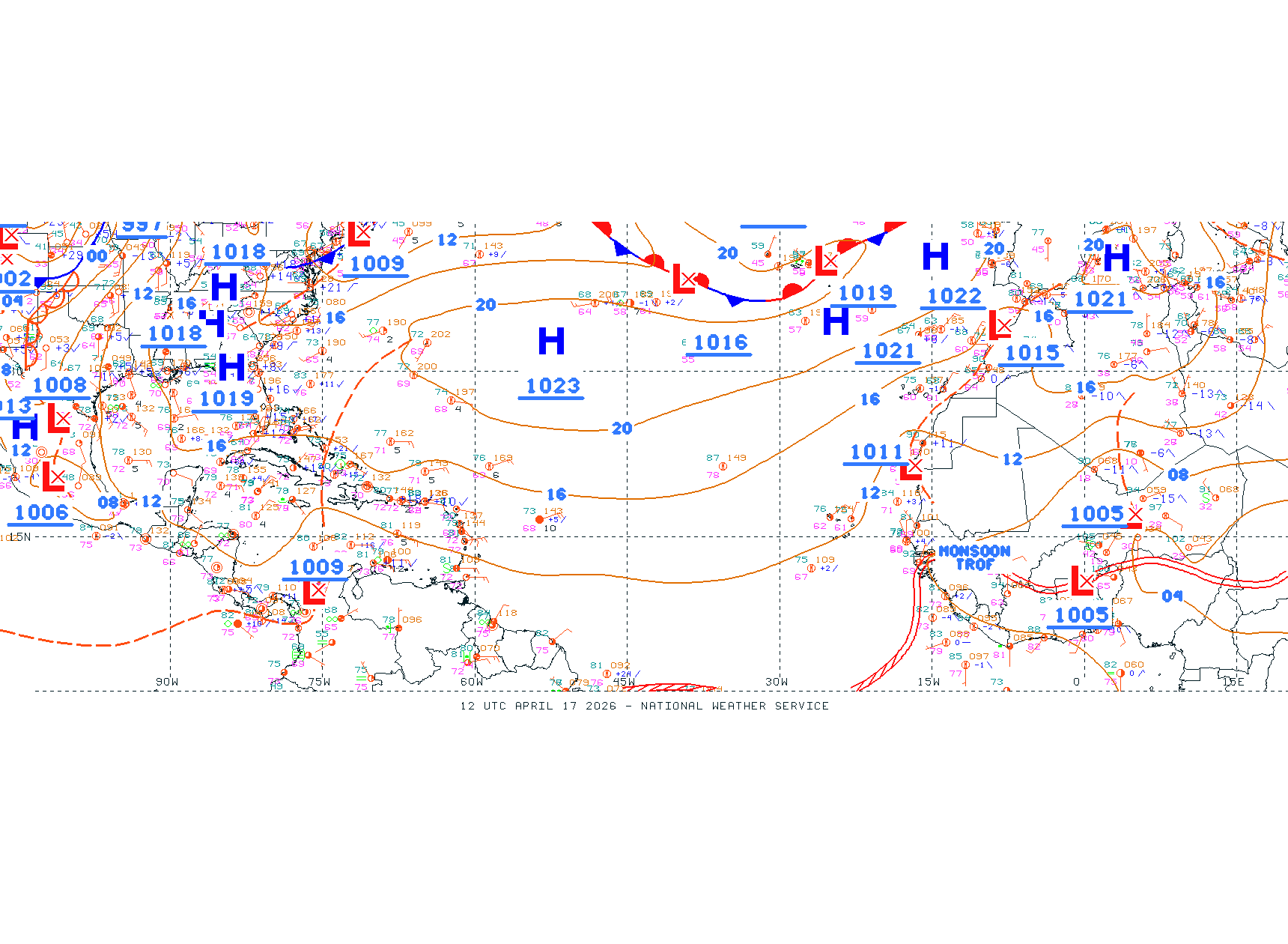
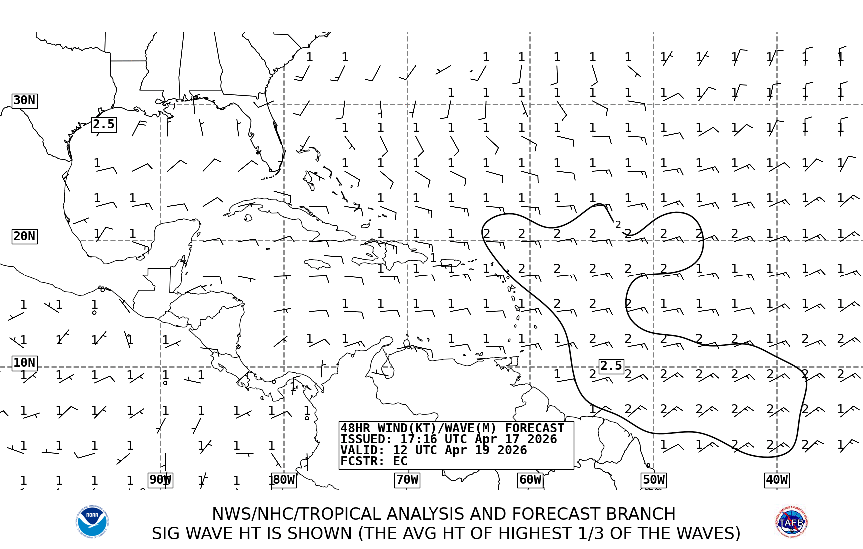
The North Atlantic is dominated by a deep cut-off low near 58°N 40°W, central pressure ~985 hPa (Chart 2), with a cold 500 hPa core (-35 °C, 525 dam) — a classic spring Atlantic storm machine. A secondary low sits SE of Greenland (~995 hPa). A 1030 hPa high extends from the Azores toward Iberia, giving the route a weak ridge for now (Chart 1). Over the route itself, gradients are slack: Biscay shows 10–15 kt westerlies, Iberian coast 10 kt N'lies, Gulf of Cádiz light and variable (Chart 4). OPC 24 h (Chart 7) confirms only 1–2 m seas south of 45°N, with a 2 m NW swell working into the Portuguese coast. Satellite (Chart 8) shows the frontal cloud band draped W-to-E across the mid-Atlantic, still well west of the route.
72-hour outlook
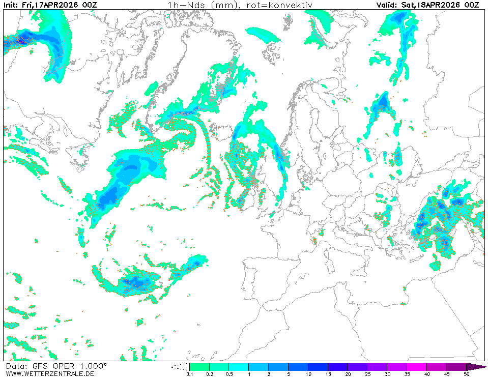
Day 1 (Sat 18 Apr) — Biscay crossing.
WNW 12–18 kt, backing W. Seas 1.5–2 m in northern Biscay, dropping to 1–1.5 m south of 46°N (Chart 7). No frontal passage over the route — front remains ~15°W.
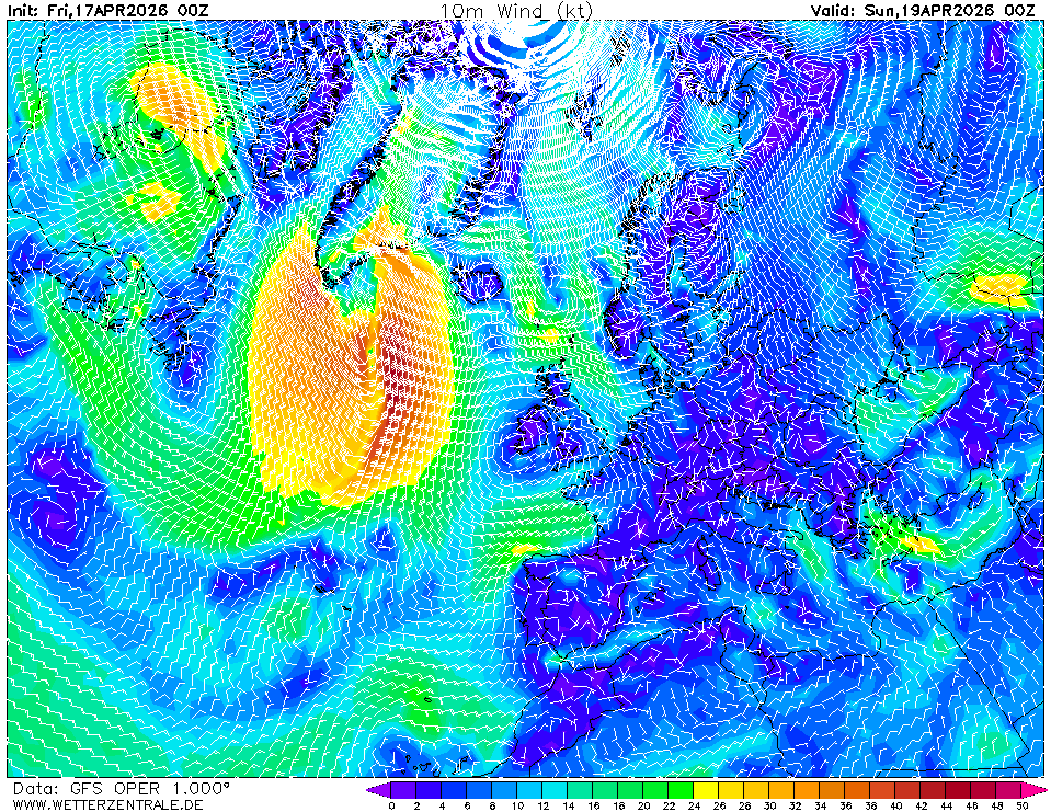
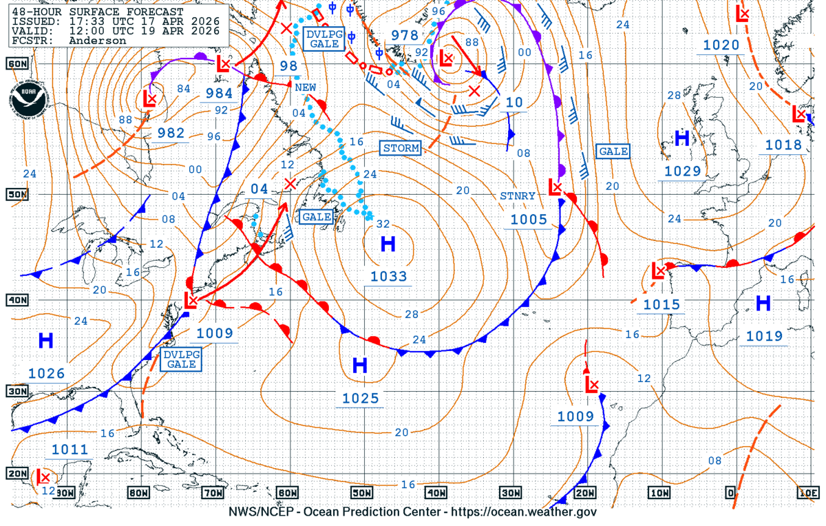
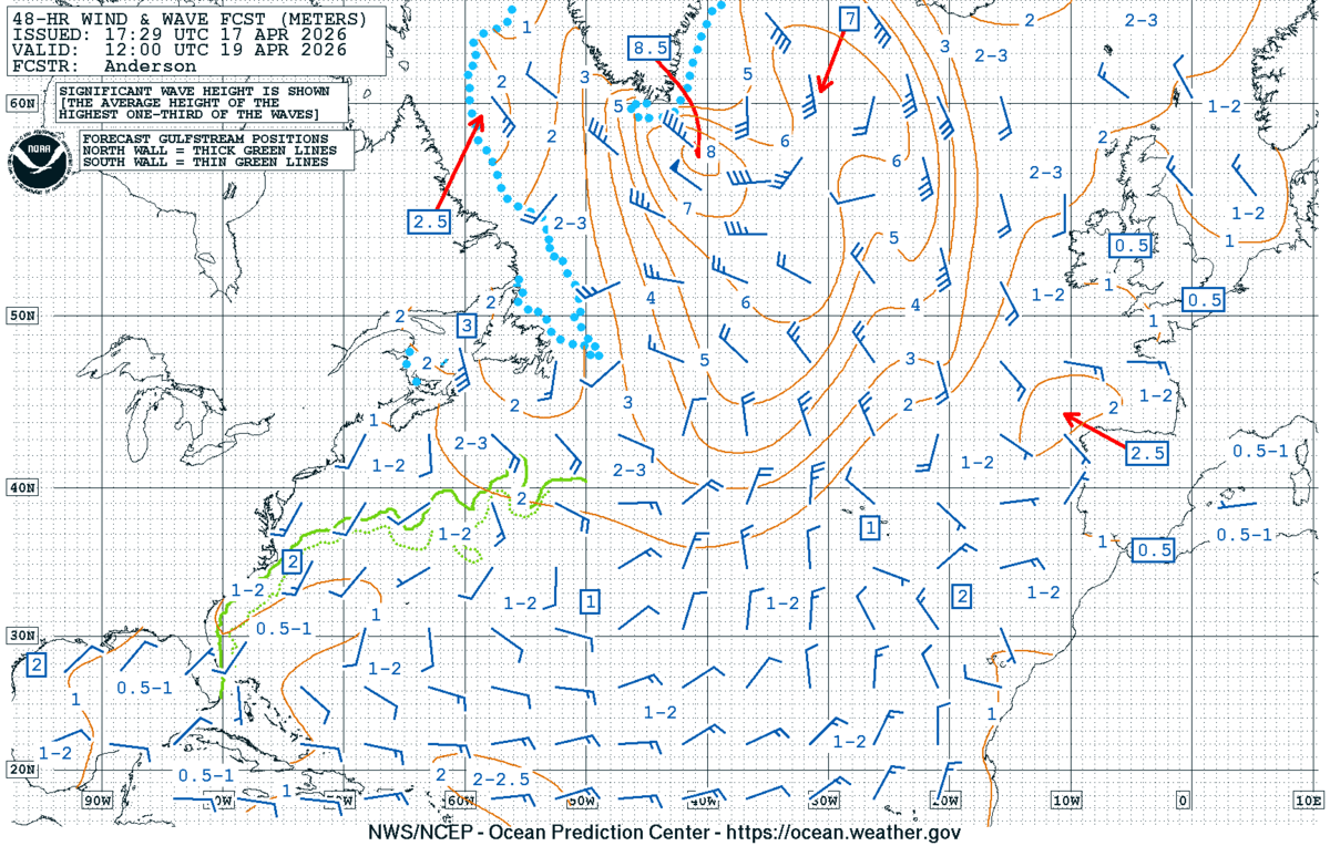
Day 2 (Sun 19 Apr) — Finisterre leg.
The Atlantic low deepens to ~985 hPa near 55°N 30°W (Chart 2) and its trailing front pushes east. Off Finisterre expect SW-W 18–25 kt, gusting 28 kt, with seas building to 2.5 m on the Iberian shelf (red arrow, Chart 6). Frontal passage possible late Sunday off NW Iberia — wind veer SW→NW, short squally period.
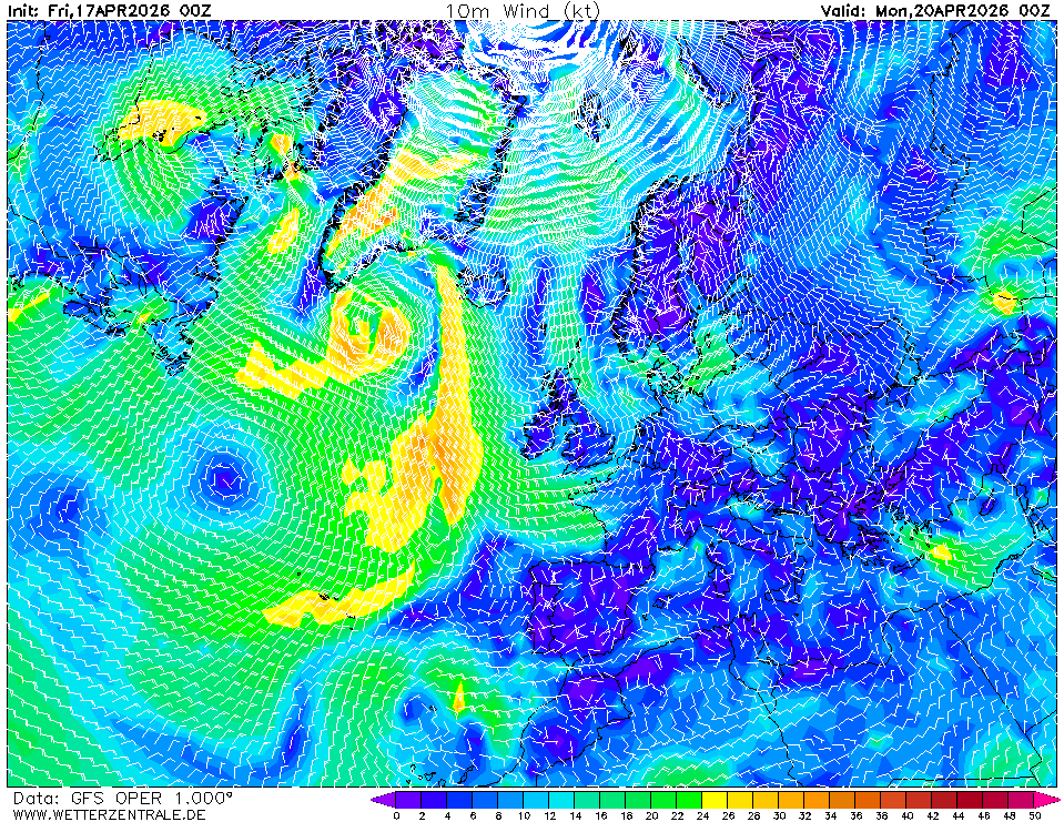
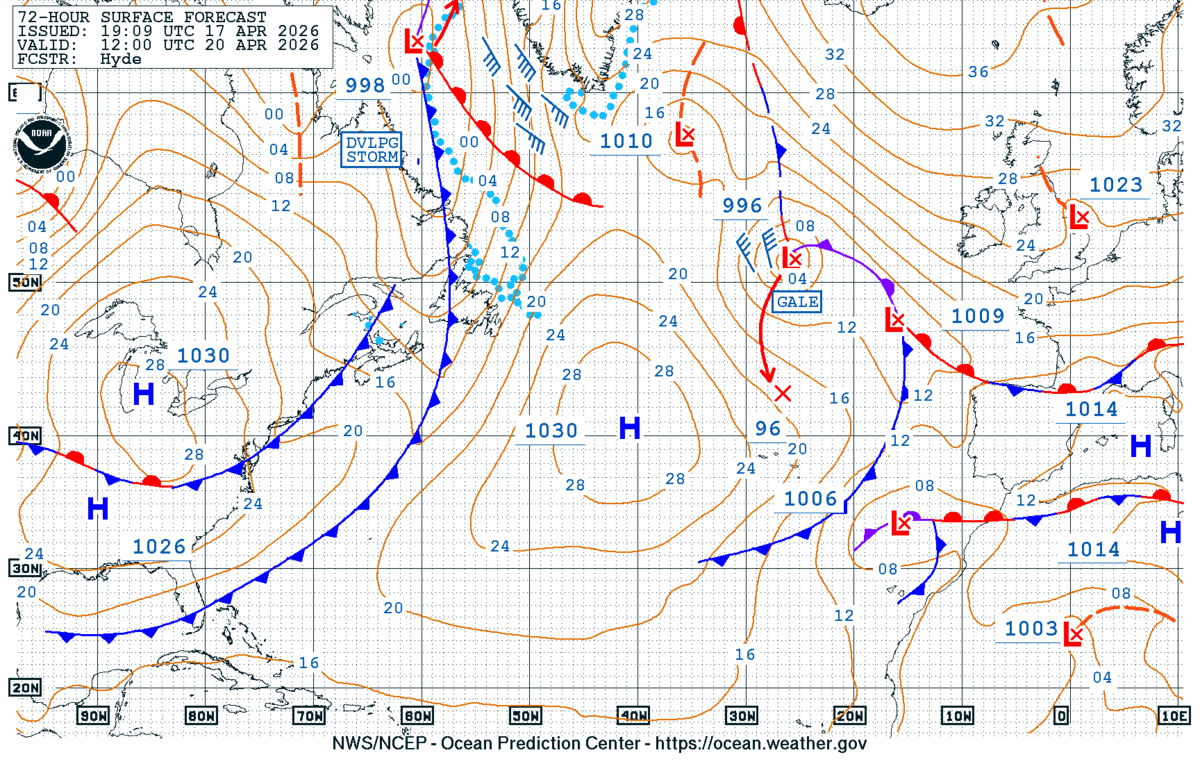
Day 3 (Mon 20 Apr) — Portugal to Cádiz.
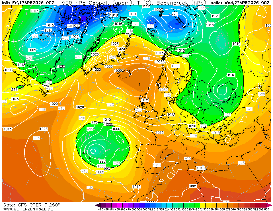
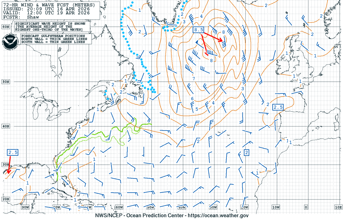
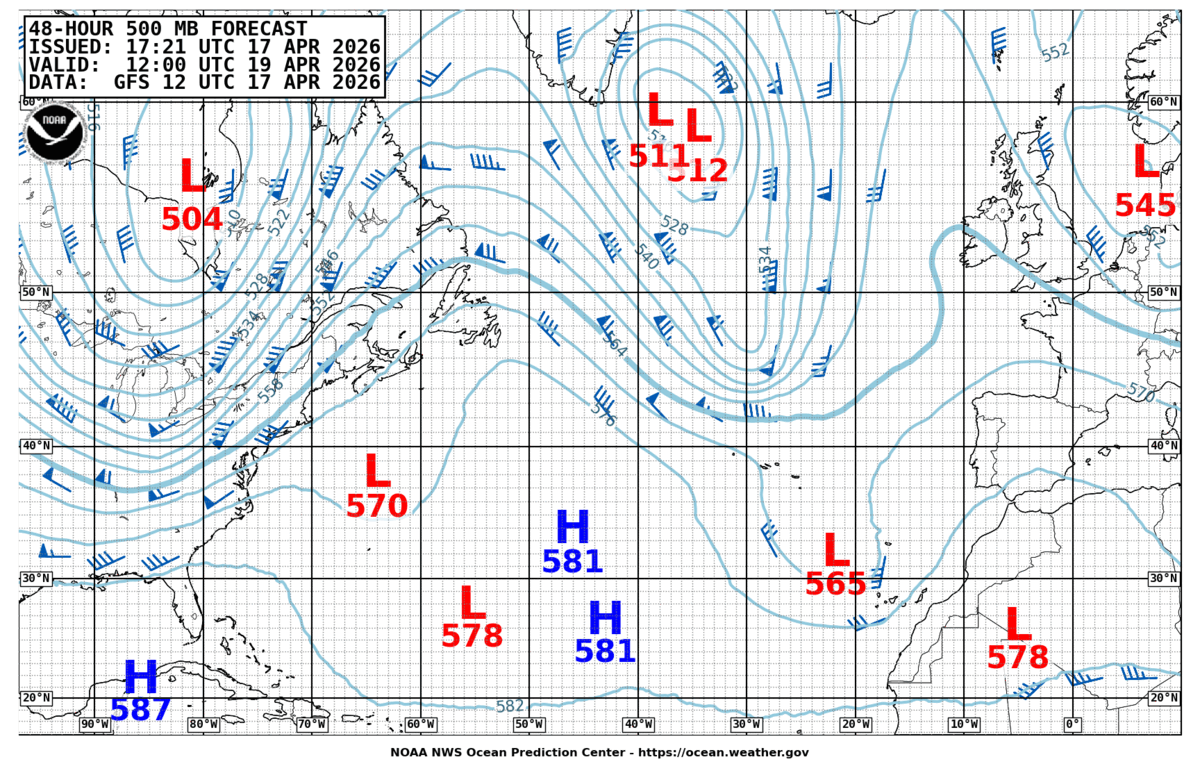
A 1035 hPa high builds into Biscay/UK (Chart 3), while a deep 1010 hPa low parks west of Iberia at ~40°N 20°W. Squeeze between them drives N-NW 15–20 kt down the Portuguese coast (Portuguese trades setting up early), seas 1.5–2 m. Gulf of Cádiz / Gibraltar approach: NE 10–15 kt, levanter signature weak but watch the Strait.
Top 3 risks to watch
- Frontal passage off Finisterre Sunday night. Chart 2 shows the front reaching 15°W; timing uncertain ±6 h. Trigger to reroute: pressure falling faster than 2 hPa/3 h at sea → stand off or shelter Bayona/Leixões.
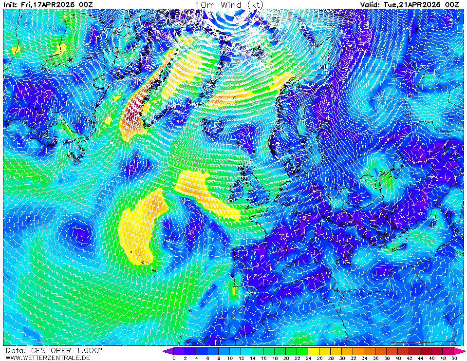
- New low west of Iberia at T+96 h (Chart 3). GFS shows a closed 1010 hPa low near 40°N 20°W with a cold 500 hPa pool (-30 °C). If it tracks east rather than stalling, Portuguese coast sees SW gale. Trigger: ECMWF agreement on eastward track in next run.
- Strait of Gibraltar wind funnel. Charts don't resolve it; synoptic gradient is light but local levanter/poniente accelerations are routine. Trigger: Tarifa observations >25 kt — time the transit for slack.
Routing considerations
Window is open — depart within 24 h. Crossing Biscay Saturday keeps you ahead of the Sunday front and ahead of the Day 3 Iberian low. Aim to be south of 43°N (Finisterre) by Sunday 12 UTC to stay in the southern/favourable semicircle of any trailing system — W-NW winds aft of the beam. Hug the Portuguese coast Monday to ride the building N'ly. Plan Strait transit on a west-going tide with confirmed <20 kt at Tarifa. Delaying departure beyond Sunday risks being caught by the T+96 h low on the Portuguese leg.