Med Trip — April 2026
Offline snapshot · fetched Fri, 17 Apr 2026 20:31:15 GMT (0.7 hr old)
Voyage
10-day Mediterranean passage. Pressure + 500 mb from GFS-Europe (Wetterzentrale), wind / precip / CAPE from same. Satellite from Meteosat MTG-I1 via SSEC Wisconsin. Atlantic-approaches fallback via NOAA OPC. Refresh before losing connectivity.
CLI equivalent: npm run voyage refresh med-apr2026
AI weather briefing
Weather Briefing — Med Trip, Fri 17 Apr 2026 20:31Z
Current synoptic setup
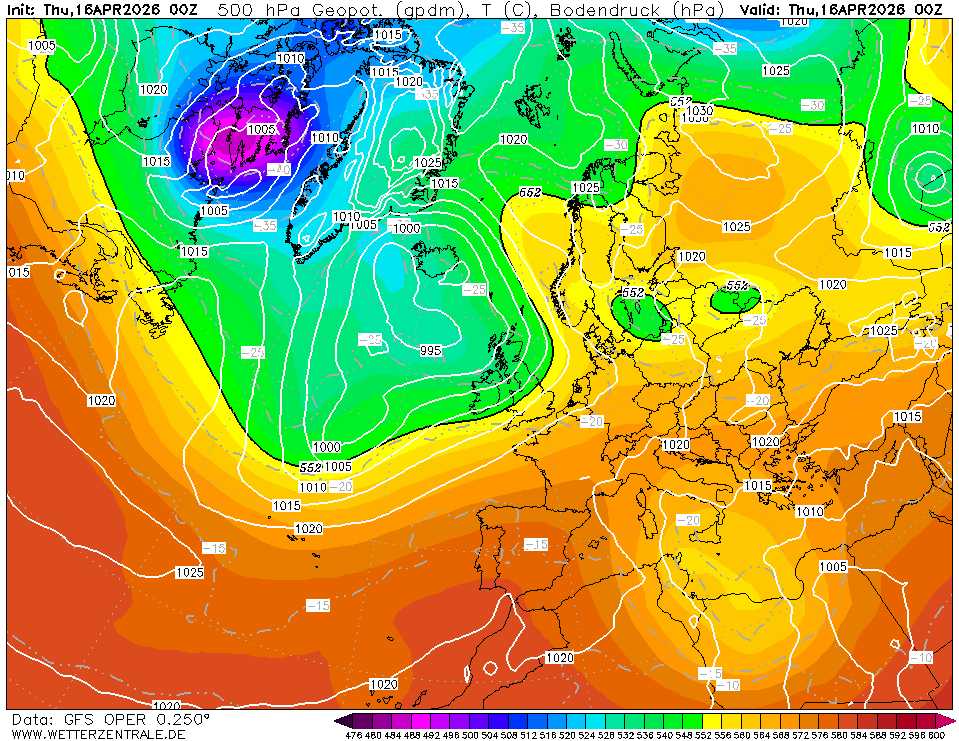
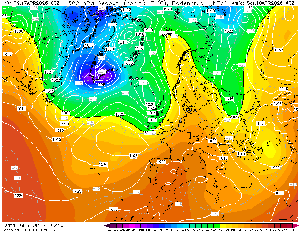
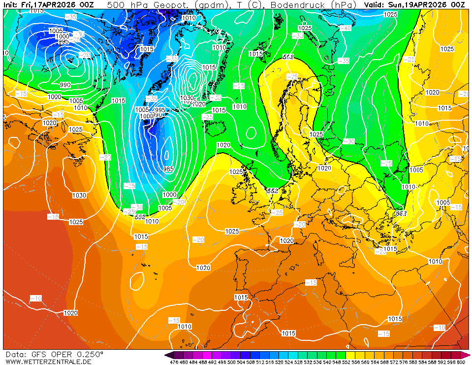
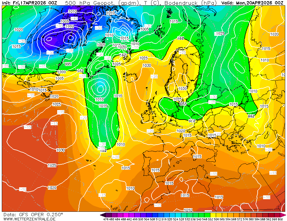
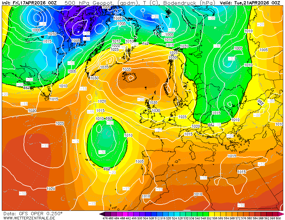
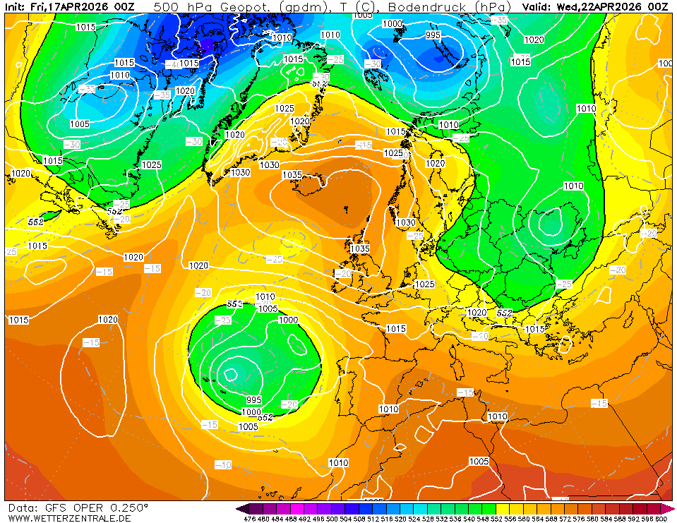
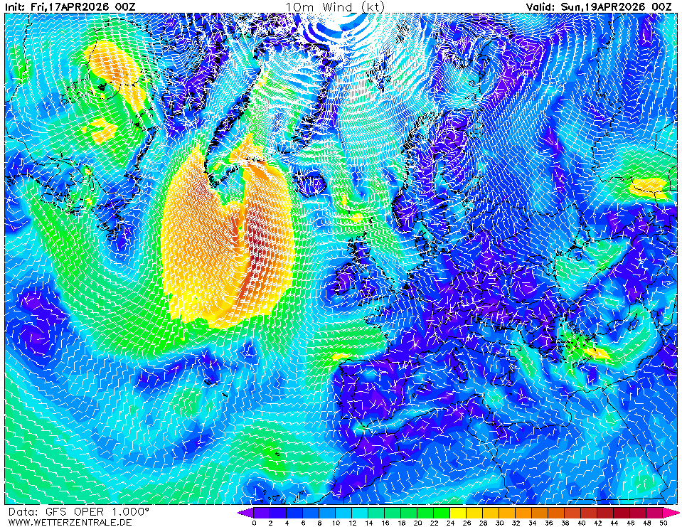
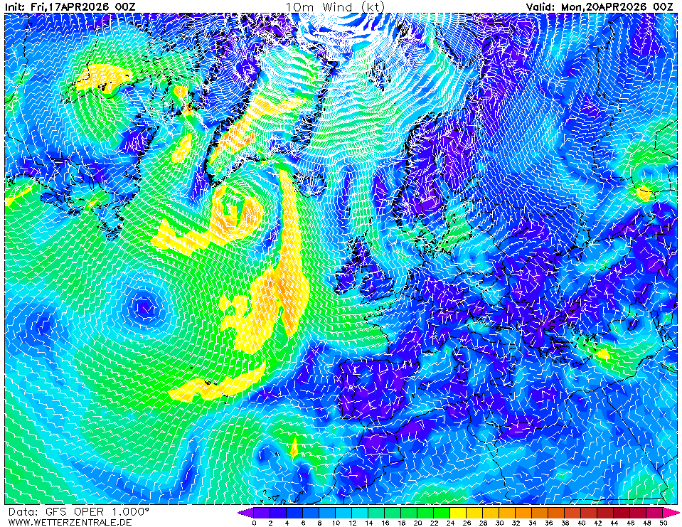
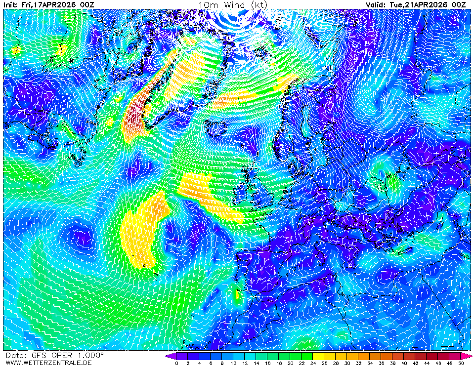
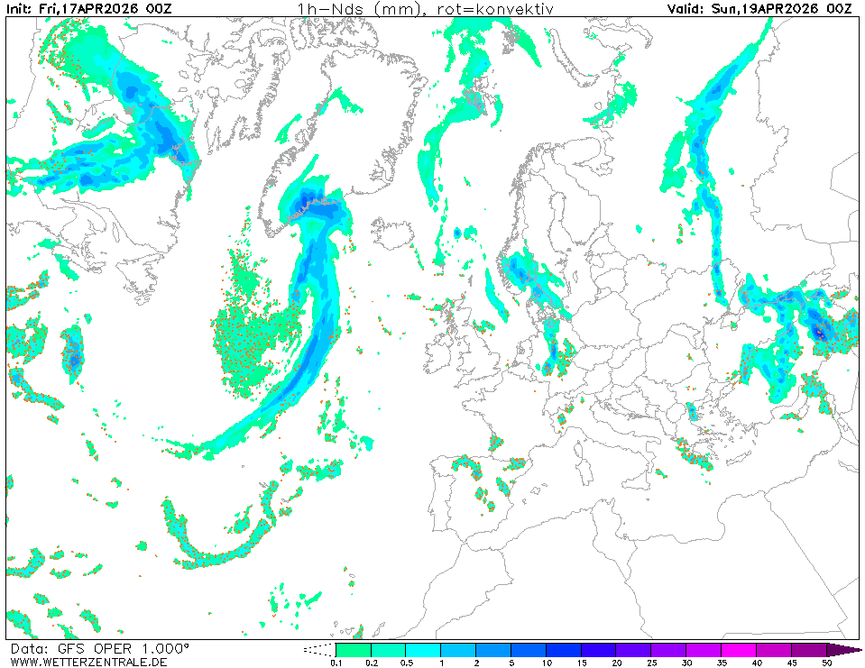
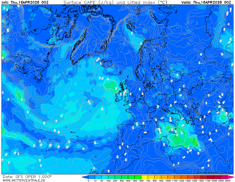
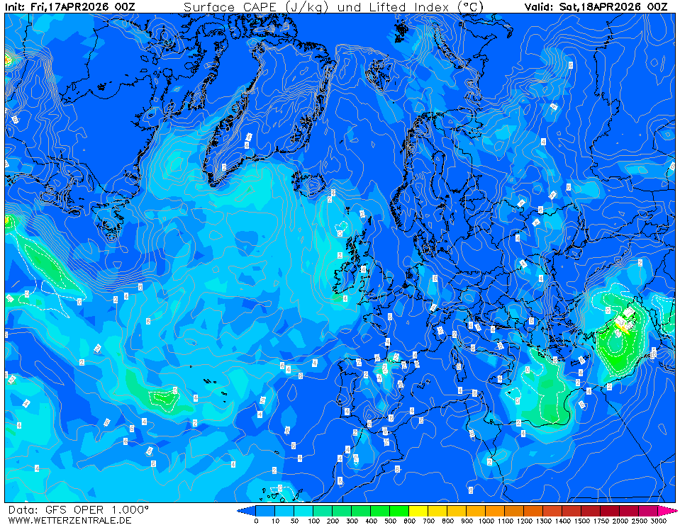
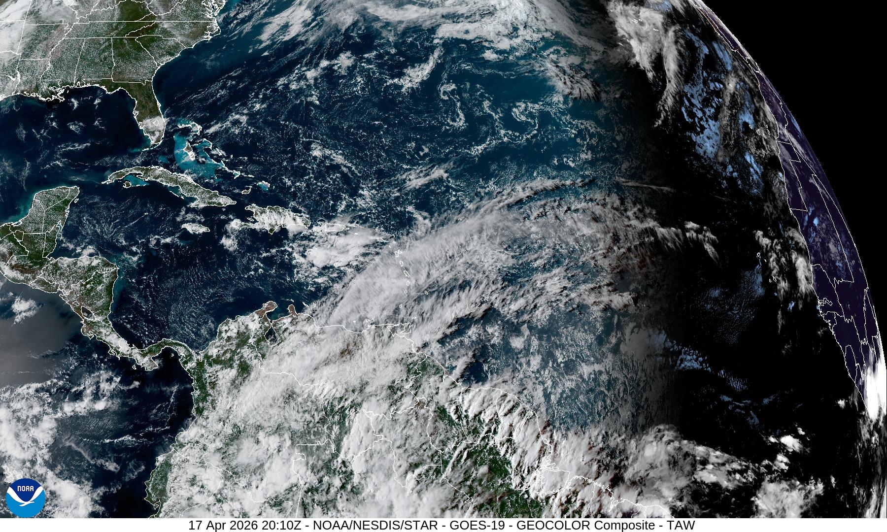
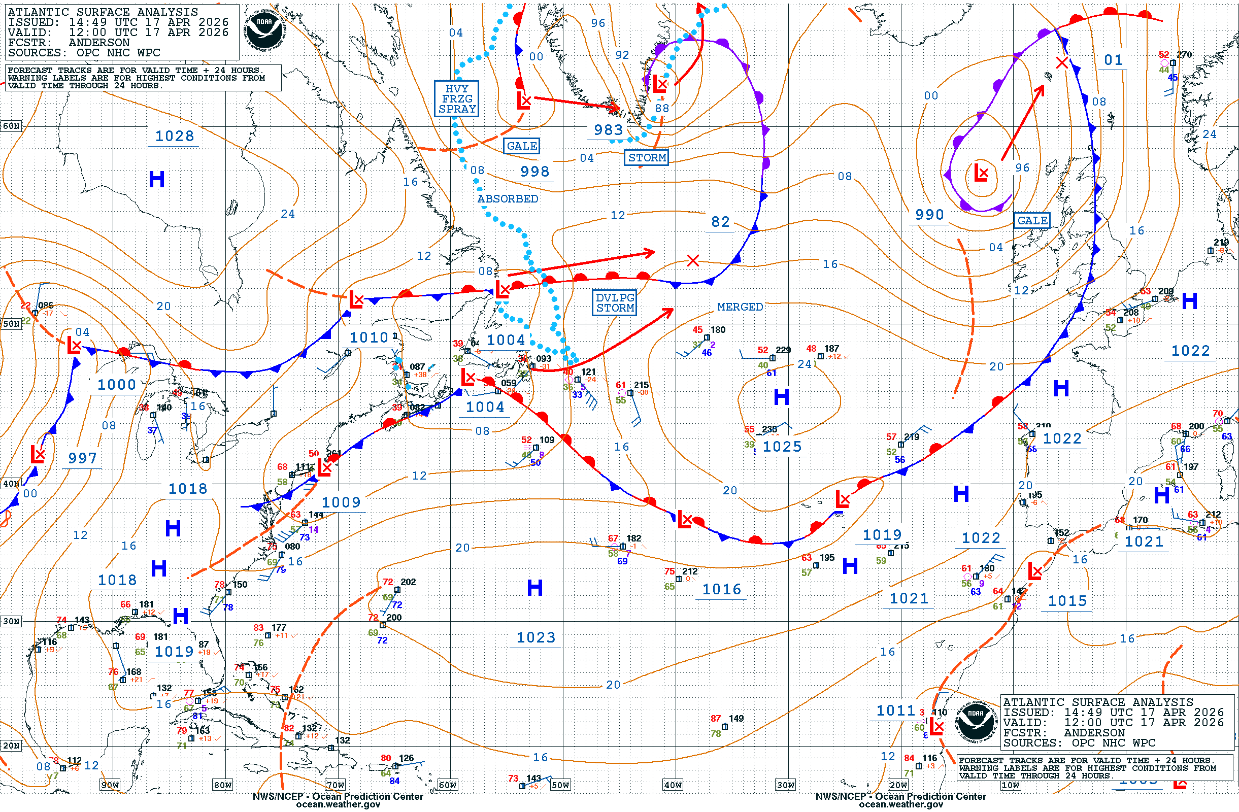
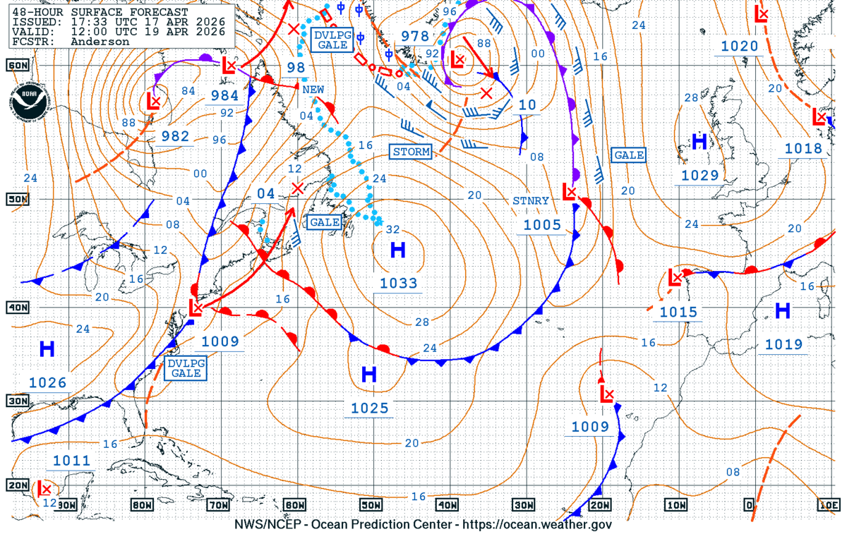
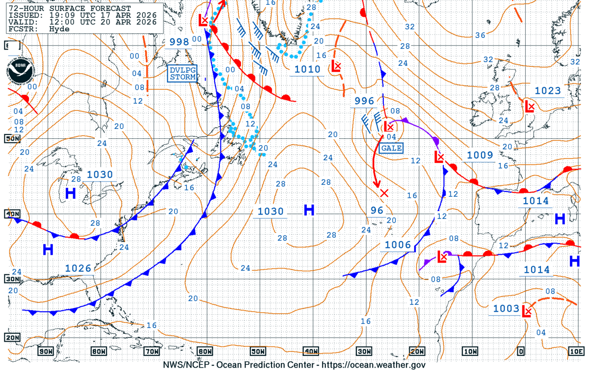
The Mediterranean basin sits under a broad, benign ridge. Chart 1 (t+0, 16 Apr 00Z) shows a 1020 hPa ridge axis running from the Azores across Iberia into the central Med, with 1020 contours covering most of the route corridor (34–45°N). The dominant feature for Europe is a deep 500 mb cold pool west of Iceland (995 hPa surface low, -35°C at 500 mb) — well north of our area. Chart 2 (valid Sun 19 Apr 00Z) deepens that North Atlantic low to 985 hPa south of Iceland, but the associated fronts stay north of 50°N. Chart 3 (Tue 21 Apr) shows a strong 1035 hPa high building over the British Isles / North Sea, with a cut-off 500 mb low (-30°C core) drifting over Iberia/Biscay — that's the feature that could reach into the western Med late in the window. Chart 6 satellite confirms a clear/fair-weather Med with only thin cirrus.
72-hour outlook
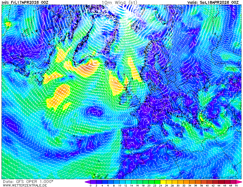
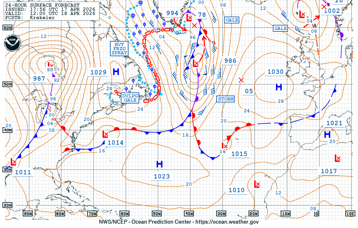
Day 1 (Sat 18 Apr) — Light pressure gradient under the 1020 hPa ridge. Winds on route predominantly NW–W 8–14 kt in the western basin (Chart 4 analysis shows 6–12 kt arrows over the Balearics/Tyrrhenian), E–NE 10–15 kt Ionian/Aegean (typical etesian pattern showing). Seas 0.8–1.5 m. No fronts.
Day 2 (Sun 19 Apr) — Chart 5 (48 h wind) shows the Med still quiet: W–NW 10–16 kt Balearics to Sardinia, NE 12–18 kt Aegean, light and variable under 8 kt central Tyrrhenian/Ionian. Seas 1–1.5 m. Distant Atlantic low (985 hPa) does not reach us.
Day 3 (Mon 20 Apr) — Ridge weakens as the Iberian cut-off (Chart 3) approaches. Expect backing to SW 12–20 kt Alboran / Balearic Sea, gusting higher near Gulf of Lion if the gradient tightens against the building 1035 hPa high to the north. Eastern Med unchanged (NE 10–15 kt). Seas building to 1.5–2.0 m west; 1.0–1.5 m east. No organised front yet over the basin.
Top 3 risks to watch
- Iberian cut-off low (Chart 3, Day 4+) — a -30°C 500 mb pool over Iberia/Biscay can spawn surface lows in the Gulf of Lion / Ligurian Sea with little warning. Uncertain: exact track and timing; GFS has been shifting cut-offs. Trigger to re-route: surface pressure falling below 1012 hPa over the Gulf of Lion, or new isobar tightening west of Sardinia.
- Mistral / Tramontane acceleration — the pressure contrast between the building 1035 hPa high (Chart 3) and any lee low in the Gulf of Lion is the classic mistral setup. Uncertain: depth of lee low. Trigger: Marseille/Perpignan METARs showing N 25+ kt and rising.
- Aegean etesian reinforcement — Chart 5 already shows 15–18 kt NE; if the eastern Med high steepens, expect 25–30 kt NE through the Cyclades channels. Trigger: Limnos/Mykonos METARs above 20 kt sustained.
Routing considerations
Window is open now. Depart on Day 1 to exploit the 1020 hPa ridge and benign seas (Charts 1, 4). Push west-to-east legs (Balearics → Sardinia → Ionian) before Day 3, when the SW'ly freshens ahead of the Iberian cut-off. If transiting the Gulf of Lion, clear it by Sun 19 Apr evening. For any developing low in the western basin later in the week, favour the southern semicircle (lighter winds, following sea on an eastbound track). Aegean legs: plan NE-facing harbours for overnight stops — etesian is building.
Advisory only — verify against GRIB and local METAR before committing, and refresh before losing connectivity.